Global Remote Sensing Technologies and Market 2017-2023 Featuring Airbus, Digitalglobe, MdDA Information Systems, Parrot, Precisionhawk, Scanex and Surrey Satellite Technology
PR Newswire
DUBLIN, Nov. 13, 2018
DUBLIN, Nov. 13, 2018 /PRNewswire/ —
The “Remote Sensing Technologies and Global Markets” report has been added to ResearchAndMarkets.com’s offering.

The purpose of the study is to provide market size and forecasts for remote sensing. The publisher believes that the market is going through renewed growth thanks to a new generation of remote sensing technologies.Remote sensing as defined by the U.S. National Oceanic and Atmospheric Administration (NOAA) as the science of obtaining information about objects or areas from a distance typically from aircraft or satellites. The information is obtained by interpreting data collected by remote sensors in the form of energy that is reflected from the earth’s surface.
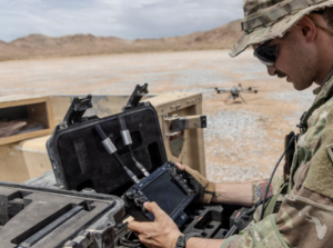
This simple definition belies a complex market where advanced technology is applied to solve difficult problems. Companies in the field today utilize precision unmanned drones and aircraft, imaging satellites, deep learning, audio analytics and intelligent modeling among other technologies to provide the data scientists, researchers, governments and companies require to understand and solve environmental and commercial issues.
The Report Includes:
- An overview of the global market for remote sensing technologies
- Analyses of global market trends, with data from 2017, estimates for 2018, and projections of compound annual growth rates (CAGRs) through 2023
- A look at the major remote sensing platforms, key remote sensing instruments, and applications accounting for the bulk of the industry
- Discussion about remote sensing image analysis techniques
- Coverage of remote sensing patents, including patent abstracts and the names of the inventors and original patent assignees
- Description of the major organizations that form and support the global remote sensing community
- Company profiles of major players in the market including Airbus, Digitalglobe, MdDA Information Systems Inc., Parrot SA, Precisionhawk, Scanex and Surrey Satellite Technology Ltd. (SST)
Key Topics Covered:
Chapter 1 Introduction
- Study Goals and Objectives
- Reasons for Doing This Study
- Scope of Report
- Information Sources
- Methodology
- Geographic Breakdown
- Analyst’s Credentials
- Custom Research
- Related Reports
Chapter 2 Summary and Highlights
Chapter 3 Market and Technology Background
- Remote Sensing Technology
- Passive Remote Sensing
- Seismic Instruments
- Infrasound
- Active Remote Sensing
- Radar
- Lasers and Lidar
- Sonar
Chapter 4 Market Breakdown by Platform
- Airborne Platforms
- Aquatic Platforms
- Space-based Platforms
- Terrestrial Platforms
- Mobile Terrestrial Platforms
- Earthscope
Chapter 5 Market Breakdown by Application
- Climate Research
- Disaster Management
- Energy
- Forestry
- Hydrology
- Infrastructure
- Oceanography
- Security
Chapter 6 Market Breakdown by Region
- North America
- Europe
- Asia Pacific
- Rest of World
Chapter 7 Analysis of Market Opportunities
- Geospatial Analytics
- Application-Focused Remote Sensing
- Big Data Challenges
Chapter 8 Company Profiles
- Agrible
- Airbus
- Airware
- Awhere
- Blacksky Global
- Ceres Imaging
- Descartes Labs
- Digitalglobe
- Ecometrica
- Enevo
- Gamaya
- Identified Technologies
- Intelinair
- Intelligent Modelling
- Less Industries
- Mavrx
- MDA Information Systems Inc.
- Open Cosmos
- Parrot Sa
- Pentalum Technologies
- Planet Labs Inc.
- Precisionhawk
- Prospera
- Rezatec
- Satellogic
- Slantrange
- Scanex
- Surrey Satellite Technology Ltd. (Sst)
- Taranis
- Teledyne Caris
- Terra Bella
- Terra Remote Sensing Inc.
- Terravion
- UAV-IQ
- Urthecast
For more information about this report visit https://www.researchandmarkets.com/research/g93f8s/global_remote?w=5
Media Contact:
Laura Wood, Senior Manager
press@researchandmarkets.com
For E.S.T Office Hours Call +1-917-300-0470
For U.S./CAN Toll Free Call +1-800-526-8630
For GMT Office Hours Call +353-1-416-8900
U.S. Fax: 646-607-1907
Fax (outside U.S.): +353-1-481-1716
 View original content:
SOURCE Research and Markets