 By
By 
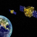
New geospatial satellite startup Nuview emerged from stealth mode on Thursday, with plans to build the first commercial LiDAR satellite constellation. LiDAR — which stands for Light Detection and Ranging — collects 3D data of Earth. Nuview says the issue is that only about 5 percent of the Earth’s landmass has been mapped with LiDAR, which is collected from aircraft, and current satellite imagery is 2D. A Nuview representative told Defense Daily's sister publication Via Satellite the company aims to have a 20-satellite…