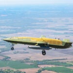
Scientists at the National Center for Atmospheric Research (NCAR) in Boulder, CO, are working on a system that would provide pilots on transoceanic flights more precise information about violent storms and clear air turbulence in their flight path.

The NCAR researchers are working in partnership with colleagues at the University of Wisconsin to develop a system that combines satellite data and computer weather models with cutting-edge artificial intelligence techniques.

The research took on added meaning after the June 1 fatal crash of Air France Flight 447, which plunged into the south Atlantic while flying from Rio de Janeiro to Paris. All 228 passengers and crewmembers were killed after the jetliner flew into a severe storm.

The NCAR system, being developed with funding from NASA, combines satellite data and computer weather models with cutting-edge artificial intelligence techniques to identify and predict rapidly evolving storms and other potential areas of turbulence.

The system is based on products that NCAR previously developed to alert pilots and air traffic controllers about storms and turbulence over the continental United States.

The team has created global maps of clear air turbulence based on global computer weather models that include winds and other instabilities in the atmosphere. Drawing on satellite images of storms, the scientists also have created global views of the tops of storm clouds. Higher cloud tops often are associated with more intense storms, although not necessarily with turbulence.

“Pilots currently have little weather information as they fly over remote stretches of the ocean, which is where some of the worst turbulence encounters occur,” says NCAR scientist John Williams. “Providing pilots with at least an approximate picture of developing storms could help guide them safely around areas of potentially severe turbulence.”

The component of the system that identifies major storms over the ocean is already available for aircraft use on an experimental basis.

A full prototype system, which will identify areas of turbulence in clear air as well as within nasty storms, is on track for testing next year. Pilots on selected transoceanic routes will receive real-time turbulence updates and then provide feedback on the system to NCAR. The researchers will adjust the system as needed.

When the research is completed in about two years, the weather system will provide pilots and ground-based controllers with text-based maps and graphical displays showing regions of likely turbulence and of storms.

Pinpointing turbulence over the oceans is far more challenging than over land because of sparse observations. Weather satellites are often the only source of information over these remote regions. But the satellites tend to provide images less frequently than over land, which can make it difficult to capture fast-changing conditions, and they do not directly measure turbulence.

Pilots of transoceanic flights currently get preflight weather briefings and in-flight weather updates every four hours if they face storms. They also rely on onboard weather radar.

All this information, however, is of limited value. Thunderstorms may develop quickly and move rapidly, rendering the briefings and weather updates obsolete. Onboard radars are designed to detect clouds and precipitation, but turbulence is often located far from the most intense precipitation.

As a result, pilots often must choose between detouring hundreds of miles around potentially stormy areas or taking a chance and flying directly through a region that may or may not contain intense weather.

NCAR currently provides real-time maps of turbulence at various altitudes over the continental United States.

“It seems likely that the information provided by a real-time uplink of weather conditions ahead would have, at a minimum, improved the (Air France) pilots’ situational awareness,” reasons Williams.

Williams and his colleagues have recently completed two critical steps in identifying turbulence over the oceans:

The team has created global maps of clear air turbulence based on global computer weather models that include winds and other instabilities in the atmosphere.

Drawing on satellite images of storms, the scientists have created global views of the tops of storm clouds. Higher cloud tops are often correlated with intense storms, although not necessarily with turbulence.

The next step is to identify areas of possible turbulence within and around intense storms. To do so, the team will study correlations between storms and turbulence over the continental United States where weather is more closely observed.

The scientists will then infer the likelihood of turbulence associated with storms over the oceans, keying in on satellite indicators such as rapidly expanding clouds or places where the tops of storm clouds are cooling quickly.

They will also develop mathematical equations to account for differences in cloud systems over the United States compared to over the oceans, including the tropics.

In addition to providing aircraft and ground controllers with up-to-the-minute maps of turbulence, the NCAR team is turning to an artificial intelligence technique, known as “random forests,” to provide short-term forecasts of turbulence.

The random forests, which have proven useful for forecasting thunderstorms over land, consist of many decision trees that each cast a yes-or-no “vote” on crucial elements of a storm at future points in time and space. This enables scientists to forecast the movement and strength of the storm over the next few hours.

“Our goal is to give pilots a regularly updated picture of the likely storms ahead as they fly over the ocean so they can take action to minimize turbulence and keep their aircraft out of danger,” explained NCAR scientist Cathy Kessinger, a project team member.

“Even over the middle of the ocean, where we don’t have land-based radars or other tools to observe storms in detail, we can still inform pilots about the potential for violent downdrafts, turbulence, and possibly lightning,” she believes.

“Turbulence is the leading cause of injuries in commercial aviation,” said John Haynes, program manager in the Earth Science Division’s Applied Sciences Program at NASA headquarters in Washington. “This new work to detect the likelihood of turbulence associated with oceanic storms using key space-based indicators is of crucial importance to pilots.”

A variety of NASA spacecraft observations are being used in the project, including data from NASA’s Terra, Aqua, Tropical Rainfall Measuring Mission, CloudSat and CALIPSO satellites.