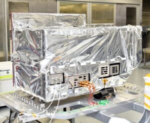
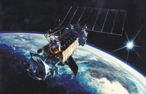
General Atomics has completed the Initial Design Review (IDR) of the space vehicle and ground segment for the United States Space Force (USSF) Space and Missile Systems Center (SMC) Electro-Optical Infrared (EO/IR) Weather System (EWS) satellite program, the company’s Electromagnetic Systems Group (GA-EMS) said on Apr. 29.

“This is the first major milestone in the EWS program that aims to deploy a space vehicle that can meet all of the military’s cloud characterization and theater imagery product requirements in time to replace the current, aging Defense Meteorological Satellite Program (DMSP),” GA-EMS said.

Lockheed Martin

[LMT] built the constellation of DMSP satellites, first launched in 1962. The DMSP-19 satellite became inoperable in 2016 due to a power failure and was not replaced, while the 12th DMSP satellite exploded on orbit that same year.

Scott Forney, president of GA-EMS, said in a statement that the company “is on track to deliver a prototype EWS system by 2022 capable of filling gaps in critical weather data for the U.S. military as the DSMP approaches the end of its lifecycle.”

“Our low SWaP-C prototype is on the path to be the first satellite in a future constellation architecture that will provide better performance, resiliency, and mission assurance, as well as less than a one-hour revisit time—ensuring timely and accurate weather forecast data for the warfighter and national security missions,” Forney said.

The GA-EMS teammates on EWS include EOVista, LLC, Atmospheric and Environmental Research Inc. (AER), and Parsons Corporation [PSN]. EOVista provides the EO/IR sensor payload, AER performs weather product generation, and Parsons provides the mission’s Enterprise Ground Station command and control, and operations support.

Nick Bucci, vice president of GA-EMS Missile Defense and Space Systems, said in the GA-EMS statement that the GA-EMS EWS prototype uses “an advanced small satellite design and an enhanced sensor with significant weather imaging upgrades that meet all current and future weather needs.”

“The elegance of this satellite design leads to reduced system cost while significantly improving performance over the system lifecycle, leading the way for other USSF missions to reduce cost while improving capabilities and resilience,” he said. “The combination of low cost sensor and satellite bus enables procurement of a disaggregated, global constellation that provides an organic, resilient and timely global cloud characterization capability and other weather products to U.S. warfighters.”